
The Brief
LoveLove Films were commissioned by the national mapping agency for Great Britain, Ordnance Survey, to produce a video demonstrating the benefits and features of their OS Maps app to potential users.
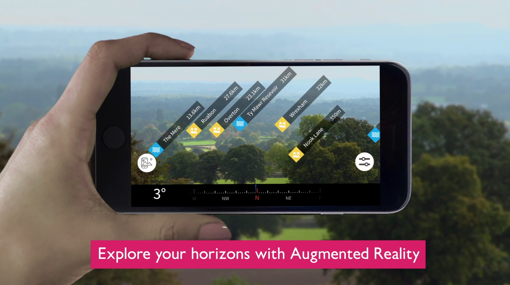
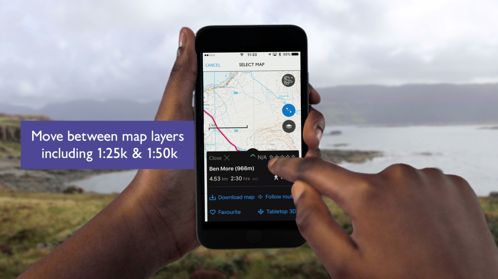
The OS Maps app allows users have their maps across all their devices, create, record and discover amazing routes to follow and also uses technology such as AR and aerial 3D imagery to make the most of their outdoor experiences. Ordnance Survey wanted all these points highlighted in a short engaging video.
The Process
The LoveLove Films team developed a mixed-media video which included hands coming into shot and using a phone in front still imagery of nature seamlessly integrated to look like the person is really there.
To create this video, we shot a range of different people using the OS Maps in front of our green screen before placing them into the scene and adding motion graphic text of all the key points Ordnance Survey wanted highlighted within the video.
The Result
Ordnance Survey were thrilled with the final video which through both the visual construction and storyline demonstrates all the benefits and features of the OS Maps app.
We have since been commissioned on 2 further projects for Ordnance Survey. More info on these soon.